Photos & Videos
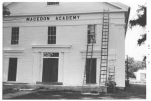
Preston Pierce presentation on the Parcel Post System – mailing children wasn’t the only strange items mailed through the USPS. Presented at the Macedon Academy on June 29, 2025.
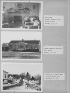
This book contains pictures of my Eagle Scout Project. To everyone that helped, thank you. The dates of the work were: May 28, 1994; May 29, 1994; June 10, 1994. -Dan Weykman
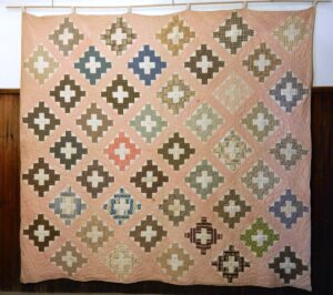
A memory quilt, a remembrance quilt, a signature quilt – three labels for one apparent item. The goal of these quilts in the mid-1800’s was to remember those who have perhaps left the area, perhaps have died, or perhaps remembering a circle of friends when one left the area. In…
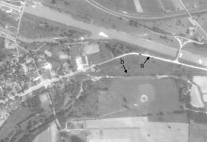
The area along Route 31 east of the village where Berry Plastics and Gravino Park are now located has changed extensively over the years. Click the images to enlarge and view information.
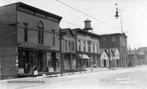
Click images to enlarge and view the full descriptions. A series of 10 views of the north east corner of Main Street and Erie Street.
Click images to enlarge. This stately cobblestone house stood along Route 31 in front of what is now the Lowe’s parking lot. Approximate coordinates: 43.064571, -77.368945 This mill was located on the west side of Walworth Road between Mill Road and Pond Road. Approximate coordinates: 43.123334, -77.272690
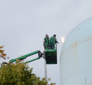
The water tank on the hill next to the village cemetery was built in 1956 by the Pittsburgh – Des Moines Steel Company. It held 500,000 gallons of water and was filled from wells located north of Route 31 and west of Canandaigua Road. It was built to improve water…
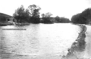
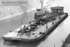
Click photos to enlarge. Along the Erie Canal Erie Canal Locks 60 & 61 Building the Barge Canal